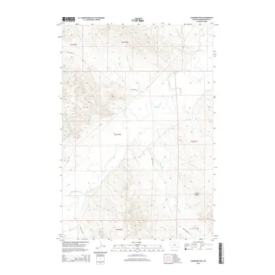
2014 Map of Lonesome Peak
USGS Topo · Published 2014About this map
The Powder River carves a winding path through this southeastern Montana landscape, joined by a dense network of tributaries including Bog Springs Cr and Baking Powder Cr. The terrain is defined by the prominent Lonesome Peak, which overlooks a complex system of ridges and gulches such as Deep Gulch Cr. This area of Powder River County remains largely pastoral and open, with cattle-country infrastructure indicated by the Garr Reservoir and several named access routes. Remote roads like Baking Powder Rd and Cache Creek Rd connect these isolated drainages. The convergence of the Boulder River and the main river channel highlights the importance of water management in this arid ranching environment, where local landmarks often take their names from the surrounding natural features and early settler camps.
Find a feature on this map
29 named features on this map. Tap any name to fly to it.
Don’t see what you’re looking for? This feature index may not catch every label — zoom into the map to look around manually.
Map Details
Editions of this 2014 Lonesome Peak Map
This is the sole edition of this map. No revisions or reprints were ever made.
Other maps of this area

1954 · Ekalaka
USGS Topo · 1:250,000

1956 · Ekalaka
USGS Topo · 1:250,000

1958 · Ekalaka
USGS Topo · 1:250,000

1965 · Ekalaka
USGS Topo · 1:250,000

1970 · Baldy Peak
USGS Topo · 1:24,000

1970 · Huckins School
USGS Topo · 1:24,000

1970 · Bear Skull Mountain
USGS Topo · 1:24,000

1973 · Lonesome Peak
USGS Topo · 1:24,000
1973 · Yarger Butte
USGS Topo · 1:24,000
1973 · Eldon Mountain
USGS Topo · 1:24,000