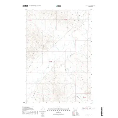
2020 Map of Lonesome Peak
USGS Topo · Published 2020About this map
The Powder River meanders through this portion of Powder River County, Montana, carving a distinctive path through the high plains and badlands. This modern topographical survey captures the complex drainage systems that feed into the river, including Baking Powder Cr and Bog Springs Cr, which cut through the local terrain. The map is defined by prominent topographical landmarks like Lonesome Peak and Clay Butte, which serve as natural navigation points in a landscape sparse with permanent structures.
Find a feature on this map
29 named features on this map. Tap any name to fly to it.
Don’t see what you’re looking for? This feature index may not catch every label — zoom into the map to look around manually.
Map Details
Editions of this 2020 Lonesome Peak Map
This is the sole edition of this map. No revisions or reprints were ever made.
Other maps of this area

1954 · Ekalaka
USGS Topo · 1:250,000

1956 · Ekalaka
USGS Topo · 1:250,000

1958 · Ekalaka
USGS Topo · 1:250,000

1965 · Ekalaka
USGS Topo · 1:250,000

1970 · Baldy Peak
USGS Topo · 1:24,000

1970 · Huckins School
USGS Topo · 1:24,000

1970 · Bear Skull Mountain
USGS Topo · 1:24,000

1973 · Lonesome Peak
USGS Topo · 1:24,000
1973 · Yarger Butte
USGS Topo · 1:24,000
1973 · Eldon Mountain
USGS Topo · 1:24,000