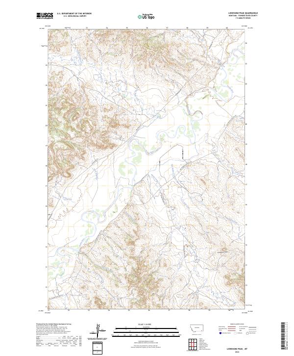
2024 Map of Lonesome Peak
USGS Topo · Published 2024About this map
The Powder River meanders through this landscape, creating a distinct hydrological corridor defined by extensive tributary networks. Notable among these is the uniquely named Baking Powder Creek, which flows past the prominent elevation of Lonesome Peak. The area's infrastructure is sparse, characterized by long rural routes such as Moorhead Rd and Big Powder River East Rd that trace the terrain's natural contours. This 2024 data represents a modern perspective on a territory that remains largely defined by its water sources and topography.
Find a feature on this map
27 named features on this map. Tap any name to fly to it.
Don’t see what you’re looking for? This feature index may not catch every label — zoom into the map to look around manually.
Map Details
Editions of this 2024 Lonesome Peak Map
This is the sole edition of this map. No revisions or reprints were ever made.
Other maps of this area

1954 · Ekalaka
USGS Topo · 1:250,000

1956 · Ekalaka
USGS Topo · 1:250,000

1958 · Ekalaka
USGS Topo · 1:250,000

1965 · Ekalaka
USGS Topo · 1:250,000

1970 · Baldy Peak
USGS Topo · 1:24,000

1970 · Huckins School
USGS Topo · 1:24,000

1970 · Bear Skull Mountain
USGS Topo · 1:24,000

1973 · Lonesome Peak
USGS Topo · 1:24,000
1973 · Yarger Butte
USGS Topo · 1:24,000
1973 · Eldon Mountain
USGS Topo · 1:24,000