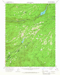
1956 Map of Long Barn
USGS Topo · Published 1967About this map
Stanislaus National Forest serves as the backdrop for this mid-century survey of the High Sierra foothills, where timber and hydroelectric power interests converged. The landscape is defined by the steep canyons of the Middle Fork Stanislaus River and South Fork Stanislaus River, which fuel significant infrastructure like the Beardsley Lake spillway and Spring Gap Powerhouse. Smaller settlements like Long Barn and Twain Harte show a mix of early resort development and logging roots, connected by a dedicated Logging Railroad and proximity to Calaveras Big Trees State Park.
Find a feature on this map
77 named features on this map. Tap any name to fly to it.
Don’t see what you’re looking for? This feature index may not catch every label — zoom into the map to look around manually.
Map Details
Editions of this 1956 Long Barn Map
3 editions found
Other maps of this area

1891 · Big Trees
USGS Topo · 1:125,000

1893 · Sonora
USGS Topo · 1:125,000

1894 · Big Trees
USGS Topo · 1:125,000

1896 · Dardanelles
USGS Topo · 1:125,000

1896 · Sonora
USGS Topo · 1:125,000

1897 · Sonora
USGS Topo · 1:125,000

1897 · Big Trees
USGS Topo · 1:125,000

1897 · Yosemite
USGS Topo · 1:125,000

1898 · Dardanelles
USGS Topo · 1:125,000

1898 · Sonora
USGS Topo · 1:125,000