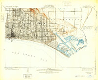
1925 Map of Long Beach
USGS Topo · Published 1932About this map
Signal Hill rises above a densely gridded coastal landscape, its contours marked by the infrastructure of an era defined by oil and rapid expansion. This survey, compiled from data by Department of the Interior and Los Angeles County officials, reveals a city in transition. The urban grid of Long Beach extends eastward until it meets the tidal complexity of Alamitos Bay and the planned canals of Naples. The presence of the Pacific Electric railway highlights the critical role of interurban rail in connecting these shoreline communities before the total dominance of the automobile.
Find a feature on this map
32 named features on this map. Tap any name to fly to it.
Don’t see what you’re looking for? This feature index may not catch every label — zoom into the map to look around manually.
Map Details
Editions of this 1925 Long Beach Map
2 editions found
Other maps of this area

1896 · Las Bolsas
USGS Topo · 1:62,500

1896 · Downey
USGS Topo · 1:62,500

1899 · Downey
USGS Topo · 1:62,500

1901 · Southern California Sheet No. 1
USGS Topo · 1:250,000

1902 · Downey
USGS Topo · 1:62,500

1904 · Southern California Sheet No. 1
USGS Topo · 1:250,000
1923 · Artesia
USGS Topo · 1:24,000

1923 · Wilmington
USGS Topo · 1:24,000
1924 · Compton
USGS Topo · 1:24,000
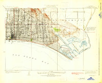
1925 · Long Beach
USGS Topo · 1:24,000