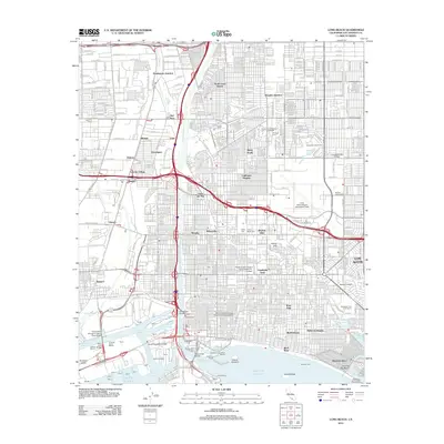
2012 Map of Long Beach
USGS Topo · Published 2012About this map
The Los Angeles River cuts a prominent path through this 2012 landscape, reaching the Pacific Ocean at a highly industrial waterfront shaped by the Inner Harbor and the Back Channel. The map details a dense urban network where long-standing neighborhoods like Bixby Knolls, California Heights, and Cambodia Town meet the maritime infrastructure of Terminal Island. Notable landmarks include the historic Queen Mary docked at Queensway Landing and the expansive Long Beach Airport (Daugherty Field).
Find a feature on this map
68 named features on this map. Tap any name to fly to it.
Don’t see what you’re looking for? This feature index may not catch every label — zoom into the map to look around manually.
Map Details
Editions of this 2012 Long Beach Map
This is the sole edition of this map. No revisions or reprints were ever made.
Other maps of this area

1896 · Redondo
USGS Topo · 1:62,500

1896 · Las Bolsas
USGS Topo · 1:62,500

1896 · San Pedro
USGS Topo · 1:62,500

1896 · Downey
USGS Topo · 1:62,500

1899 · Downey
USGS Topo · 1:62,500

1901 · Southern California Sheet No. 1
USGS Topo · 1:250,000

1902 · Downey
USGS Topo · 1:62,500

1904 · Southern California Sheet No. 1
USGS Topo · 1:250,000

1923 · Wilmington
USGS Topo · 1:24,000
1924 · Compton
USGS Topo · 1:24,000