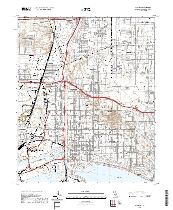
2021 Map of Long Beach
USGS Topo · Published 2021About this map
The Los Angeles River cuts a prominent path through this 2021 survey of the coastal landscape, connecting the industrial corridors of Compton and Carson to the activity of Queensway Bay. The map documents a dense grid of neighborhoods including Bixby Knolls, California Heights, and the distinct enclave of Signal Hill, which stands as its own topographic high point above the surrounding plains. The shoreline is highly engineered, featuring artificial landmarks like Island Grissom and Island White within the Los Angeles Harbor.
Find a feature on this map
87 named features on this map. Tap any name to fly to it.
Don’t see what you’re looking for? This feature index may not catch every label — zoom into the map to look around manually.
Map Details
Editions of this 2021 Long Beach Map
This is the sole edition of this map. No revisions or reprints were ever made.
Other maps of this area

1896 · Redondo
USGS Topo · 1:62,500

1896 · Las Bolsas
USGS Topo · 1:62,500

1896 · San Pedro
USGS Topo · 1:62,500

1896 · Downey
USGS Topo · 1:62,500

1899 · Downey
USGS Topo · 1:62,500

1901 · Southern California Sheet No. 1
USGS Topo · 1:250,000

1902 · Downey
USGS Topo · 1:62,500

1904 · Southern California Sheet No. 1
USGS Topo · 1:250,000

1923 · Wilmington
USGS Topo · 1:24,000
1924 · Compton
USGS Topo · 1:24,000