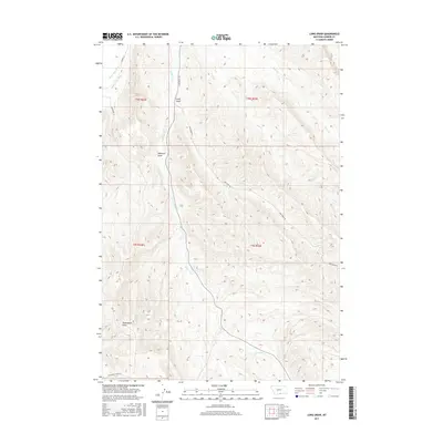
2017 Map of Long Draw
USGS Topo · Published 2017About this map
Silver Tip Cr winds through the heart of this Montana landscape, cutting a path through the drainages of Carbon County. The terrain is defined by its extensive system of draws, including the central Long Draw and the more southern Williams Draw and Hollenbeck Draw. These features demonstrate the natural erosion patterns of the region, where seasonal runoff has carved distinct paths through the high plains. In the northwest corner, the presence of the River View Ditch and Rocky Point Ditch highlights the critical role of water management and irrigation in this semi-arid environment. The road network is sparse but functional, with routes like Long Draw Rd and Hollenbeck Draw Rd providing access to these remote areas, while Lovers Ln and Musgrave Ln suggest small-scale residential or ranching activity near the water diversions.
Find a feature on this map
17 named features on this map. Tap any name to fly to it.
Don’t see what you’re looking for? This feature index may not catch every label — zoom into the map to look around manually.
Map Details
Editions of this 2017 Long Draw Map
This is the sole edition of this map. No revisions or reprints were ever made.
Other maps of this area

1944 · Red Lodge
USGS Topo · 1:62,500

1950 · Clark
USGS Topo · 1:62,500

1954 · Billings
USGS Topo · 1:250,000

1955 · Cody
USGS Topo · 1:250,000

1957 · Billings
USGS Topo · 1:250,000

1958 · Billings
USGS Topo · 1:250,000

1958 · Cody
USGS Topo · 1:250,000

1962 · Cody
USGS Topo · 1:250,000

1966 · Elk Basin
USGS Topo · 1:24,000

1966 · Elk Basin NW
USGS Topo · 1:24,000