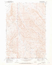
1969 Map of Long Draw
USGS Topo · Published 1973About this map
Elk Basin Oil Field dominates the southeastern quadrant of this Carbon County landscape, revealing an intensive network of Drill Holes, oil wells, and a prominent Pipeline that cuts north-south through the terrain. This industrial development is set against the drainage systems of Silver Tip Creek and Long Draw, where the topography reflects the complex water management required for the region. Evidence of irrigation and early water rights is visible in the northern reach with the Clarks Fork Silver Tip Ditch and View Ditch near Rocky Point. The map captures a moment of active resource extraction, specifically noting localized landmarks such as Higham Well and High Well, which serve as primary navigational and industrial points within the basin's arid draws and creek beds.
Find a feature on this map
16 named features on this map. Tap any name to fly to it.
Don’t see what you’re looking for? This feature index may not catch every label — zoom into the map to look around manually.
Map Details
Editions of this 1969 Long Draw Map
This is the sole edition of this map. No revisions or reprints were ever made.
Other maps of this area

1944 · Red Lodge
USGS Topo · 1:62,500

1950 · Clark
USGS Topo · 1:62,500

1954 · Billings
USGS Topo · 1:250,000

1955 · Cody
USGS Topo · 1:250,000

1957 · Billings
USGS Topo · 1:250,000

1958 · Billings
USGS Topo · 1:250,000

1958 · Cody
USGS Topo · 1:250,000

1962 · Cody
USGS Topo · 1:250,000

1966 · Elk Basin
USGS Topo · 1:24,000

1966 · Elk Basin NW
USGS Topo · 1:24,000