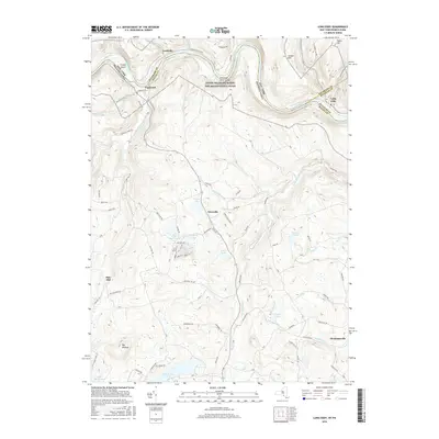
2016 Map of Long Eddy
USGS Topo · Published 2016About this map
The Delaware River serpentines through the high plateaus of the Upper Delaware valley, serving as a liquid border between Pennsylvania and New York. This 2016 survey highlights the Upper Delaware Scenic and Recreational River corridor, where historic riverfront settlements like Lordville and Equinunk sit tucked against the steep valley walls. The geography here is defined by deep tributary incisions such as Equinunk Creek and Little Equinunk Creek, which drain a highland landscape dotted with glacial depressions like Duck Harbor Pond and Margaret Lake. To the southeast, the crossroads at Abrahamsville and Pine Mill represent the enduring rural character of Wayne County. The map provides a detailed view of the local road network, including the winding Bouchouxville Road, which provides access to the Delaware River Gorge and riverfront features like Frisbie Island.
Find a feature on this map
81 named features on this map. Tap any name to fly to it.
Don’t see what you’re looking for? This feature index may not catch every label — zoom into the map to look around manually.
Map Details
Editions of this 2016 Long Eddy Map
This is the sole edition of this map. No revisions or reprints were ever made.
Other maps of this area

1892 · Honesdale
USGS Topo · 1:62,500

1920 · Long Eddy
USGS Topo · 1:62,500

1920 · Damascus
USGS Topo · 1:62,500

1921 · Long Eddy
USGS Topo · 1:48,000

1923 · Damascus
USGS Topo · 1:62,500

1923 · Long Eddy
USGS Topo · 1:62,500

1924 · Starrucca
USGS Topo · 1:48,000

1926 · Starrucca
USGS Topo · 1:62,500

1930 · Starrucca
USGS Topo · 1:48,000

1933 · Starrucca
USGS Topo · 1:62,500