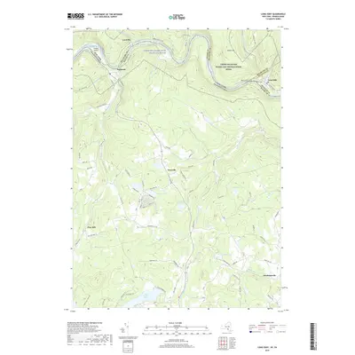
2019 Map of Long Eddy
USGS Topo · Published 2019About this map
The Delaware River carves a deep valley along the border of Pennsylvania and New York, serving as the central artery for this river-valley landscape. The waterway winds through the Delaware River Gorge, flanked by the settlements of Lordville, Equinunk, and Long Eddy. This region is defined by its recreation-rich environment, protected in part by the Upper Delaware Scenic and Recreational River corridor. Away from the main river valley, the terrain rises into upland areas dotted with several notable water bodies, including Union Lake, Duck Harbor Pond, and Margaret Lake.
Find a feature on this map
87 named features on this map. Tap any name to fly to it.
Don’t see what you’re looking for? This feature index may not catch every label — zoom into the map to look around manually.
Map Details
Editions of this 2019 Long Eddy Map
This is the sole edition of this map. No revisions or reprints were ever made.
Other maps of this area

1892 · Honesdale
USGS Topo · 1:62,500

1920 · Long Eddy
USGS Topo · 1:62,500

1920 · Damascus
USGS Topo · 1:62,500

1921 · Long Eddy
USGS Topo · 1:48,000

1923 · Damascus
USGS Topo · 1:62,500

1923 · Long Eddy
USGS Topo · 1:62,500

1924 · Starrucca
USGS Topo · 1:48,000

1926 · Starrucca
USGS Topo · 1:62,500

1930 · Starrucca
USGS Topo · 1:48,000

1933 · Starrucca
USGS Topo · 1:62,500