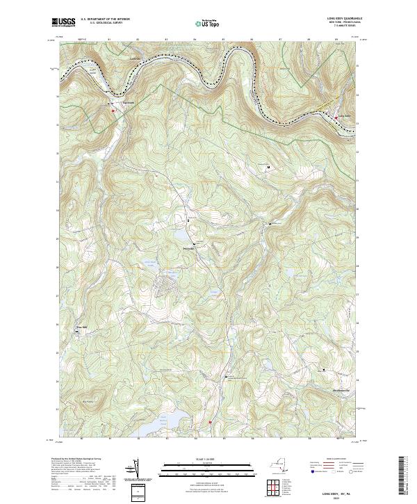
2023 Map of Long Eddy
USGS Topo · Published 2023About this map
The Delaware River carves a deep, winding path through the borderlands of New York and Pennsylvania, defining the character of this region. Along its banks, the settlements of Lordville, Equinunk, and Long Eddy serve as historic anchor points where the New York Pennsylvania railroad line follows the water's edge. The terrain is marked by numerous family and community burial sites, including the Newport Cem overlooking the river and the Priceville Cem situated further inland. High points like Big Hickory and Jensen Hill provide a sense of the vertical relief that separates the river valley from the plateau lakes such as Union Lake and Duck Harbor Pond. The landscape is further protected by State Game Lands 159 in the southwest, while the river itself is designated as the Upper Delaware Scenic and Recreational River, preserving its wild character.
Find a feature on this map
98 named features on this map. Tap any name to fly to it.
Don’t see what you’re looking for? This feature index may not catch every label — zoom into the map to look around manually.
Map Details
Editions of this 2023 Long Eddy Map
This is the sole edition of this map. No revisions or reprints were ever made.
Other maps of this area

1892 · Honesdale
USGS Topo · 1:62,500

1920 · Long Eddy
USGS Topo · 1:62,500

1920 · Damascus
USGS Topo · 1:62,500

1921 · Long Eddy
USGS Topo · 1:48,000

1923 · Damascus
USGS Topo · 1:62,500

1923 · Long Eddy
USGS Topo · 1:62,500

1924 · Starrucca
USGS Topo · 1:48,000

1926 · Starrucca
USGS Topo · 1:62,500

1930 · Starrucca
USGS Topo · 1:48,000

1933 · Starrucca
USGS Topo · 1:62,500