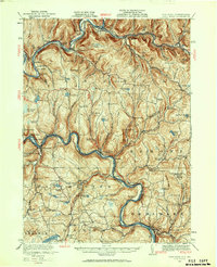
1920 Map of Long Eddy
USGS Topo · Published 1960About this map
The Delaware River serves as the winding boundary between New York and Pennsylvania in this 1920 survey, where the river's path dictates the placement of early rail lines and river-front settlements. The Erie RR follows the southern bank through Equinunk and Long Eddy, while the New York Ontario and Western RR services the northern uplands and valley of the Beaver Kill. This era reveals a landscape deeply organized by local education and industry, evidenced by the high density of rural schoolhouses such as Priceville School, Tyler Wood School, and Gould School, alongside the Buckingham Factory near the river bend.
Find a feature on this map
100 named features on this map. Tap any name to fly to it.
Don’t see what you’re looking for? This feature index may not catch every label — zoom into the map to look around manually.
Map Details
Editions of this 1920 Long Eddy Map
3 editions found
Other maps of this area

1892 · Honesdale
USGS Topo · 1:62,500

1920 · Long Eddy
USGS Topo · 1:62,500

1920 · Damascus
USGS Topo · 1:62,500

1921 · Long Eddy
USGS Topo · 1:48,000

1921 · Livingston Manor
USGS Topo · 1:62,500

1922 · White Lake
USGS Topo · 1:62,500

1922 · Andes
USGS Topo · 1:62,500

1923 · Damascus
USGS Topo · 1:62,500

1923 · Long Eddy
USGS Topo · 1:62,500

1923 · Walton
USGS Topo · 1:48,000