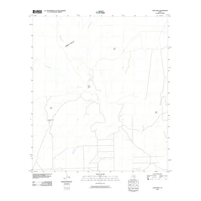
2010 Map of Long Hills
USGS Topo · Published 2010About this map
Terlingua Creek and its seasonal tributaries carve a complex drainage system through this portion of Brewster County, characterized by the broad expanse of Green Valley and the prominent Long Hills. The landscape is defined by its arid-land hydrology, where ephemeral features like Crystal Creek and Musgrave Creek converge toward the main channel. Settlement in this remote Big Bend region is sparse, represented by isolated ranching infrastructure such as the Hammond Ranch, which includes the Hammond Ranch Lake Dam. Further north, Burnt House Camp sits along the creek bank, marking a specific site of human activity amidst the topographical markers of Point Draw and Hale Draw. The network of unimproved roads and tracks illustrated here reflects the necessary adaptations for navigating this high-desert environment.
Find a feature on this map
10 named features on this map. Tap any name to fly to it.
Don’t see what you’re looking for? This feature index may not catch every label — zoom into the map to look around manually.
Map Details
Editions of this 2010 Long Hills Map
This is the sole edition of this map. No revisions or reprints were ever made.
Other maps of this area

1917 · Agua Fria
USGS Topo · 1:62,500

1917 · Tascotal Mesa
USGS Topo · 1:62,500

1917 · Buck Hill
USGS Topo · 1:62,500

1918 · Buck Hill
USGS Topo · 1:62,500

1918 · Jordan Gap
USGS Topo · 1:62,500

1925 · Buck Hill
USGS Topo · 1:62,500

1930 · Jordan Gap
USGS Topo · 1:62,500

1937 · Agua Fria
USGS Topo · 1:62,500

1944 · Tascotal Mesa
USGS Topo · 1:62,500

1959 · Emory Peak
USGS Topo · 1:250,000