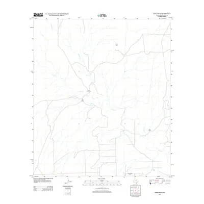
2012 Map of Long Hills
USGS Topo · Published 2012About this map
Terlingua Cr serves as the primary drainage through this arid stretch of Brewster County, joined by tributaries like Crystal Cr and Musgrave Cr. The landscape is defined by its dramatic relief, specifically the namesake Long Hills and deep erosional features such as Point Draw and Hale Draw. Human presence in this high-desert environment is sparse but purposeful, represented by the isolated Burnt House Camp and the remote Taurus Mesa Airport situated near the southern boundary. The network of unimproved roads and tracks suggests a region dedicated to large-scale ranching or seasonal camps rather than dense settlement, reflecting the rugged character of the Trans-Pecos frontier as it appeared in the early 21st century.
Find a feature on this map
8 named features on this map. Tap any name to fly to it.
Don’t see what you’re looking for? This feature index may not catch every label — zoom into the map to look around manually.
Map Details
Editions of this 2012 Long Hills Map
This is the sole edition of this map. No revisions or reprints were ever made.
Other maps of this area

1917 · Agua Fria
USGS Topo · 1:62,500

1917 · Tascotal Mesa
USGS Topo · 1:62,500

1917 · Buck Hill
USGS Topo · 1:62,500

1918 · Buck Hill
USGS Topo · 1:62,500

1918 · Jordan Gap
USGS Topo · 1:62,500

1925 · Buck Hill
USGS Topo · 1:62,500

1930 · Jordan Gap
USGS Topo · 1:62,500

1937 · Agua Fria
USGS Topo · 1:62,500

1944 · Tascotal Mesa
USGS Topo · 1:62,500

1959 · Emory Peak
USGS Topo · 1:250,000