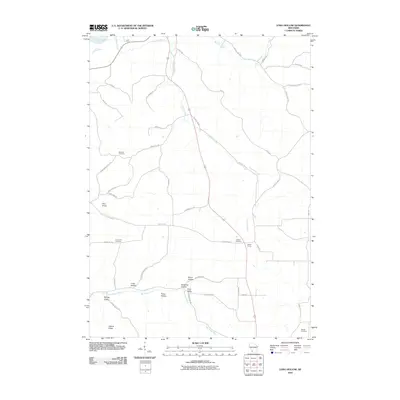
2010 Map of Long Hollow
USGS Topo · Published 2010About this map
Crooked Creek and its narrow valley carve through the heart of this Driftless Area landscape, guiding the path of Old Highway 61 toward the Wisconsin River in the northwest. The terrain is defined by a series of deeply etched drainages and ridges, including Pine Knob and Adkins Ridge, which create natural corridors for early settlement and travel. Small communities and crossroads such as Long Hollow and Walker Corner are situated along these ridges, reflecting a rural economy tied to the land.
Find a feature on this map
45 named features on this map. Tap any name to fly to it.
Don’t see what you’re looking for? This feature index may not catch every label — zoom into the map to look around manually.
Map Details
Editions of this 2010 Long Hollow Map
This is the sole edition of this map. No revisions or reprints were ever made.
Other maps of this area

1900 · Lancaster
USGS Topo · 1:125,000

1904 · Lancaster
USGS Topo · 1:125,000

1908 · Lancaster
USGS Topo · 1:125,000

1926 · Wauzeka
USGS Topo · 1:62,500

1933 · Boscobel
USGS Topo · 1:62,500

1958 · La Crosse
USGS Topo · 1:250,000

1959 · Dubuque
USGS Topo · 1:250,000

1961 · Dubuque
USGS Topo · 1:250,000

1961 · La Crosse
USGS Topo · 1:250,000

1962 · Dubuque
USGS Topo · 1:250,000