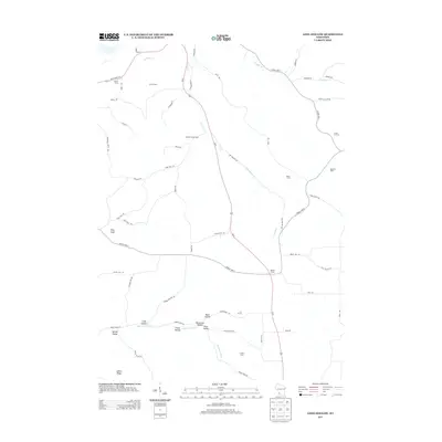
2013 Map of Long Hollow
USGS Topo · Published 2013About this map
Big Green River winds through the southern landscape of this 2013 Grant County survey, where the river valley creates a series of distinctive landforms including Long Hollow, Butternut Hollow, and Plum Valley. The area is defined by its deep-rooted agricultural character, visible through numerous named farmsteads such as Meadow Brook Farm, Trumm Farm, and the Round S Dairy. These family-named holdings are connected by a network of rural roads that navigate the high ridges and deep coulees typical of this Wisconsin region. At the center of the local transportation network, Us-61 intersects with County Hwy-T at Walker Corner, while State Road 133 skirts the northern boundary near Crooked Cr. The map provides a precise look at the rural infrastructure of the early 21st century, from the Pine Knob landmark to the scattered homesites of Spring Valley.
Find a feature on this map
58 named features on this map. Tap any name to fly to it.
Don’t see what you’re looking for? This feature index may not catch every label — zoom into the map to look around manually.
Map Details
Editions of this 2013 Long Hollow Map
This is the sole edition of this map. No revisions or reprints were ever made.
Other maps of this area

1900 · Lancaster
USGS Topo · 1:125,000

1904 · Lancaster
USGS Topo · 1:125,000

1908 · Lancaster
USGS Topo · 1:125,000

1926 · Wauzeka
USGS Topo · 1:62,500

1933 · Boscobel
USGS Topo · 1:62,500

1958 · La Crosse
USGS Topo · 1:250,000

1959 · Dubuque
USGS Topo · 1:250,000

1961 · Dubuque
USGS Topo · 1:250,000

1961 · La Crosse
USGS Topo · 1:250,000

1962 · Dubuque
USGS Topo · 1:250,000