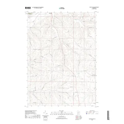
2018 Map of Long Hollow
USGS Topo · Published 2018About this map
Boscobel sits at the northern edge of this driftless area landscape, where the terrain is defined by a dense network of coulees and ridges. The Big Green River winds through the southern portion of the sheet, fed by several named drainages including Spring Valley and Plum Valley. This 2018 survey reveals a rural landscape deeply tied to its geography, with roads like Hickory Hill Rd and Crown Hill Rd following the high ground between steep descents into Long Hollow and Butternut Hollow. For genealogists and local historians, the map is a primary source for locating rural burials at Brechler Cem, Crown Hill Cem, Bethel Cem, and Switzer Cem. Small settlements such as Gunderson Valley and Coon Valley occupy the eastern reaches, while prominent landmarks like Pine Knob provide orientation across the heavily dissected topography typical of this part of Grant County.
Find a feature on this map
55 named features on this map. Tap any name to fly to it.
Don’t see what you’re looking for? This feature index may not catch every label — zoom into the map to look around manually.
Map Details
Editions of this 2018 Long Hollow Map
This is the sole edition of this map. No revisions or reprints were ever made.
Other maps of this area

1900 · Lancaster
USGS Topo · 1:125,000

1904 · Lancaster
USGS Topo · 1:125,000

1908 · Lancaster
USGS Topo · 1:125,000

1926 · Wauzeka
USGS Topo · 1:62,500

1933 · Boscobel
USGS Topo · 1:62,500

1958 · La Crosse
USGS Topo · 1:250,000

1959 · Dubuque
USGS Topo · 1:250,000

1961 · Dubuque
USGS Topo · 1:250,000

1961 · La Crosse
USGS Topo · 1:250,000

1962 · Dubuque
USGS Topo · 1:250,000