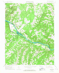
1966 Map of Long Island
USGS Topo · Published 1968About this map
The RoanOKE River carves a deep valley through the southern Piedmont in the mid-1960s, serving as the border between Campbell, Pittsylvania, and Halifax Counties. This landscape is defined by its rural settlements and the infrastructure of the Norfolk and Western railway, which follows the northern river bank through Long Island and Melrose. The map reveals a deeply rooted community structure, evidenced by the numerous congregations including First Buffalo Ch, Second Buffalo Ch, and Evergreen Ch. Near the northern border, the community of Naruna serves as a local hub, featuring the Campbell High Sch. The presence of large islands like Goat Island and Hale Islands within the river channel highlights the natural hydrology of the area before modern developments significantly altered these southern Virginia waterways.
Find a feature on this map
31 named features on this map. Tap any name to fly to it.
Don’t see what you’re looking for? This feature index may not catch every label — zoom into the map to look around manually.
Map Details
Editions of this 1966 Long Island Map
2 editions found
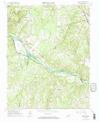
Other maps of this area

1892 · Lynchburg
USGS Topo · 1:125,000

1892 · Appomattox
USGS Topo · 1:125,000

1947 · Roanoke
USGS Topo · 1:250,000

1953 · Greensboro
USGS Topo · 1:250,000

1954 · Greensboro
USGS Topo · 1:250,000

1954 · Halifax
USGS Topo · 1:62,500

1954 · Riceville
USGS Topo · 1:62,500

1956 · Brookneal
USGS Topo · 1:62,500

1956 · Gladys
USGS Topo · 1:62,500

1959 · Roanoke
USGS Topo · 1:250,000