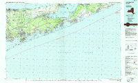
1984 Map of Long Island East
USGS Topo · Published 1985About this map
The Brookhaven National Laboratory and the sprawling Calverton National Cemetery anchor this 1984 study of eastern Long Island, where the island's distinctive "forks" begin to diverge. The landscape is a mix of dense residential growth and protected lands, including the Fire Island National Seashore and several wildlife refuges like Amagansett National Wildlife Refuge. Transportation corridors such as the Long Island Expressway and the Long Island Rail Road illustrate the region's mid-century suburbanization, while coastal landmarks like Hampton Bays and Art Village reveal the established seasonal and year-round communities of the South Shore.
Find a feature on this map
198 named features on this map. Tap any name to fly to it.
Don’t see what you’re looking for? This feature index may not catch every label — zoom into the map to look around manually.
Map Details
Editions of this 1984 Long Island East Map
3 editions found
Other maps of this area

1891 · Bridgeport
USGS Topo · 1:62,500

1893 · Bridgeport
USGS Topo · 1:62,500

1902 · Setauket
USGS Topo · 1:62,500

1902 · Fire Island
USGS Topo · 1:62,500

1903 · Fire Island
USGS Topo · 1:62,500

1903 · Sag Harbor
USGS Topo · 1:62,500

1903 · Gardiners Island
USGS Topo · 1:62,500

1903 · Riverhead
USGS Topo · 1:62,500

1904 · Setauket
USGS Topo · 1:62,500

1904 · Islip
USGS Topo · 1:125,000