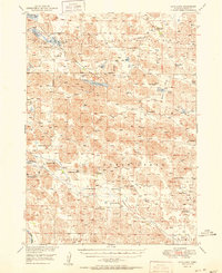
1951 Map of Long Lake
USGS Topo · Published 1951About this map
Valentine National Wildlife Refuge anchors the northern half of this landscape, characterized by an intricate network of wetlands and small lakes in the Nebraska Sandhills. The area around Long Lake and South Marsh Lake showcases a high concentration of water features, including Rat Lake and Skull Lake, which provided vital habitat and resources in this mid-century ranching territory. Settlement is defined by widely spaced family holdings such as the Schleuter Ranch, Shaul Ranch, and Higgins Bros Ranch.
Find a feature on this map
43 named features on this map. Tap any name to fly to it.
Don’t see what you’re looking for? This feature index may not catch every label — zoom into the map to look around manually.
Map Details
Editions of this 1951 Long Lake Map
2 editions found
Other maps of this area

1948 · Seneca 4
USGS Topo · 1:62,500

1949 · Seneca 4
USGS Topo · 1:62,500

1949 · Purdum
USGS Topo · 1:62,500

1949 · Koshopah
USGS Topo · 1:62,500

1949 · Long Lake
USGS Topo · 1:62,500

1950 · Simeon
USGS Topo · 1:62,500

1950 · Wood Lake
USGS Topo · 1:62,500

1950 · Arabia
USGS Topo · 1:62,500

1951 · Long Lake
USGS Topo · 1:62,500

1951 · Purdum
USGS Topo · 1:62,500