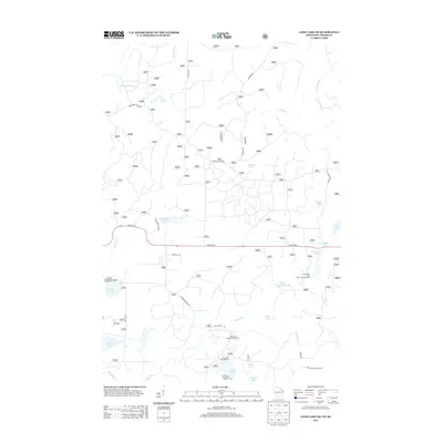
2013 Map of Long Lake NE
USGS Topo · Published 2013About this map
The Nicolet National Frst defines this landscape of glacial lakes and winding waterways in northern Wisconsin. This 2013 survey documents a region dedicated to conservation and recreation, most notably featuring the Purdue University Forestry Camp near the southern edge. The water-rich terrain is shaped by the Pine River and a dense network of creeks, including Wisconsin Cr and Lauterman Cr. Significant recreational infrastructure is mapped in detail, showing the locations of the Florence County Park Campground and several specialized sites like the Lauterman Lake Walk-In Campground and Chipmunk Rapids Campground. From the Wisconsin Slough in the northwest to Silverdollar Lake in the east, the map provides a precise look at the forest's access roads, such as Chipmunk Rapids Rd and State Hwy 70, which connect these remote destinations.
Find a feature on this map
36 named features on this map. Tap any name to fly to it.
Don’t see what you’re looking for? This feature index may not catch every label — zoom into the map to look around manually.
Map Details
Editions of this 2013 Long Lake NE Map
This is the sole edition of this map. No revisions or reprints were ever made.
Other maps of this area

1898 · Iron River
USGS Topo · 1:62,500

1899 · Crystal Falls
USGS Topo · 1:62,500

1939 · Long Lake
USGS Topo · 1:48,000

1941 · Florence
USGS Topo · 1:48,000

1944 · Iron River
USGS Topo · 1:24,000

1944 · Gaastra
USGS Topo · 1:24,000

1944 · Fortune Lakes
USGS Topo · 1:24,000

1946 · Iron River
USGS Topo · 1:31,680

1946 · Gaastra
USGS Topo · 1:31,680

1946 · Fortune Lakes
USGS Topo · 1:31,680