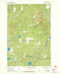
1970 Map of Long Lake NE
USGS Topo · Published 1972About this map
Nicolet National Forest dominates this northern Wisconsin landscape, where the confluence of timber management and recreational development is visible in the early 1970s. The map highlights the intersection of the Brule River and Wisconsin Slough along the Michigan-Wisconsin state line, a historic corridor for regional water travel. To the south, the Pine River snakes through the terrain near Chipmunk Rapids, while the interior is dotted with numerous named water bodies like Long Lake, Lauterman Lake, and the poetically named Lake of Dreams. Educational and recreational infrastructure is firmly established at the Purdue University Forestry Camp and Lost Lake Campground, reflecting the era's focus on forest research and public access. Traces of local extraction are found at a Gravel Pit, while a Gaging Station monitor river levels vital for this watershed.
Find a feature on this map
27 named features on this map. Tap any name to fly to it.
Don’t see what you’re looking for? This feature index may not catch every label — zoom into the map to look around manually.
Map Details
Editions of this 1970 Long Lake NE Map
This is the sole edition of this map. No revisions or reprints were ever made.
Other maps of this area

1898 · Iron River
USGS Topo · 1:62,500

1899 · Crystal Falls
USGS Topo · 1:62,500

1939 · Long Lake
USGS Topo · 1:48,000

1941 · Florence
USGS Topo · 1:48,000

1944 · Iron River
USGS Topo · 1:24,000

1944 · Gaastra
USGS Topo · 1:24,000

1944 · Fortune Lakes
USGS Topo · 1:24,000

1946 · Iron River
USGS Topo · 1:31,680

1946 · Gaastra
USGS Topo · 1:31,680

1946 · Fortune Lakes
USGS Topo · 1:31,680