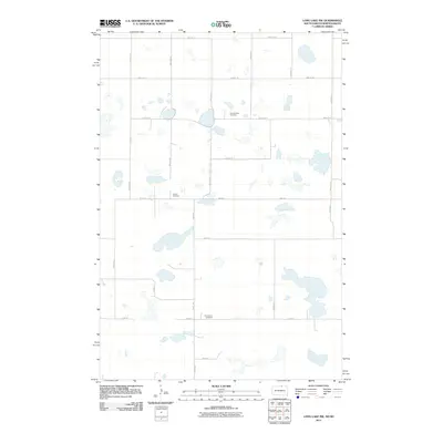
2011 Map of Long Lake NW
USGS Topo · Published 2011About this map
Johannasthal Cemetery and Jewell Cemetery sit within the expansive prairie landscape of McIntosh County, where the topography is defined by a dense network of glacial wetlands and small lakes. This 2011 survey illustrates a highly organized section-line road system, where corridors such as 98th St SE and 350th Ave dictate the movement across the terrain. The map's detail highlights the rural character of the North Dakota-South Dakota borderlands, focusing on the preservation of historical burial sites like Emmanuel Cemetery that serve as central points for the surrounding dispersed farmsteads. The lack of concentrated settlements underscores the area's continued reliance on agriculture and its preservation of early twentieth-century land divisions.
Find a feature on this map
22 named features on this map. Tap any name to fly to it.
Don’t see what you’re looking for? This feature index may not catch every label — zoom into the map to look around manually.
Map Details
Editions of this 2011 Long Lake NW Map
This is the sole edition of this map. No revisions or reprints were ever made.
Other maps of this area

1953 · Jamestown
USGS Topo · 1:250,000

1954 · Aberdeen
USGS Topo · 1:250,000

1956 · Aberdeen
USGS Topo · 1:250,000

1956 · Jamestown
USGS Topo · 1:250,000

1968 · Long Lake
USGS Topo · 1:24,000

1968 · Long Lake SE
USGS Topo · 1:24,000

1968 · Long Lake NW
USGS Topo · 1:24,000

1968 · Long Lake NE
USGS Topo · 1:24,000

1978 · Schumacher Lake
USGS Topo · 1:24,000

1978 · Schumacher Lake NE
USGS Topo · 1:24,000