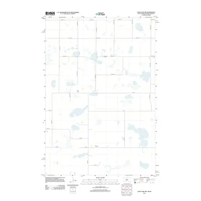
2012 Map of Long Lake NW
USGS Topo · Published 2012About this map
Stretched across the prairie landscape of McIntosh County, this high-plains region reveals a network of rural section-line roads and numerous seasonal wetlands. Three local burial grounds—Johannasthal Cem, Jewell Cem, and Emmanuel Cem—anchor the rural landscape, serving as primary genealogical landmarks for families rooted in this part of North Dakota. The map's grid-like organization, defined by routes such as 98th St SE and 60th Ave SE, reflects the enduring legacy of the Public Land Survey System. The presence of these specific named cemeteries amidst an otherwise sparse settlement pattern offers a window into the historical density of farming communities that once populated this area during the early 21st century and before.
Find a feature on this map
23 named features on this map. Tap any name to fly to it.
Don’t see what you’re looking for? This feature index may not catch every label — zoom into the map to look around manually.
Map Details
Editions of this 2012 Long Lake NW Map
This is the sole edition of this map. No revisions or reprints were ever made.
Other maps of this area

1953 · Jamestown
USGS Topo · 1:250,000

1954 · Aberdeen
USGS Topo · 1:250,000

1956 · Aberdeen
USGS Topo · 1:250,000

1956 · Jamestown
USGS Topo · 1:250,000

1968 · Long Lake
USGS Topo · 1:24,000

1968 · Long Lake SE
USGS Topo · 1:24,000

1968 · Long Lake NW
USGS Topo · 1:24,000

1968 · Long Lake NE
USGS Topo · 1:24,000

1978 · Schumacher Lake
USGS Topo · 1:24,000

1978 · Schumacher Lake NE
USGS Topo · 1:24,000