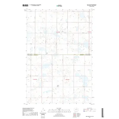
2017 Map of Long Lake NW
USGS Topo · Published 2017About this map
The state line between McIntosh County, North Dakota and McPherson County, South Dakota bisects this prairie landscape, revealing a remote terrain defined by its glacial wetlands and sectional road grid. The map highlights three significant community landmarks: Saint Johns Cem in the north, Jewell Station Cem situated along the county boundary, and Emmanuel Lutheran Cem further south. These sites provide critical anchors for genealogists and local historians tracing the settlement patterns of this border region. The presence of Old Sioux Rd suggests an older path of travel crossing the more modern township roads such as 102nd St SE and 350th Ave. This survey illustrates the persistent agricultural and cemetery sites that remain the primary evidence of the area's rural social history.
Find a feature on this map
28 named features on this map. Tap any name to fly to it.
Don’t see what you’re looking for? This feature index may not catch every label — zoom into the map to look around manually.
Map Details
Editions of this 2017 Long Lake NW Map
This is the sole edition of this map. No revisions or reprints were ever made.
Other maps of this area

1953 · Jamestown
USGS Topo · 1:250,000

1954 · Aberdeen
USGS Topo · 1:250,000

1956 · Aberdeen
USGS Topo · 1:250,000

1956 · Jamestown
USGS Topo · 1:250,000

1968 · Long Lake
USGS Topo · 1:24,000

1968 · Long Lake SE
USGS Topo · 1:24,000

1968 · Long Lake NW
USGS Topo · 1:24,000

1968 · Long Lake NE
USGS Topo · 1:24,000

1978 · Schumacher Lake
USGS Topo · 1:24,000

1978 · Schumacher Lake NE
USGS Topo · 1:24,000