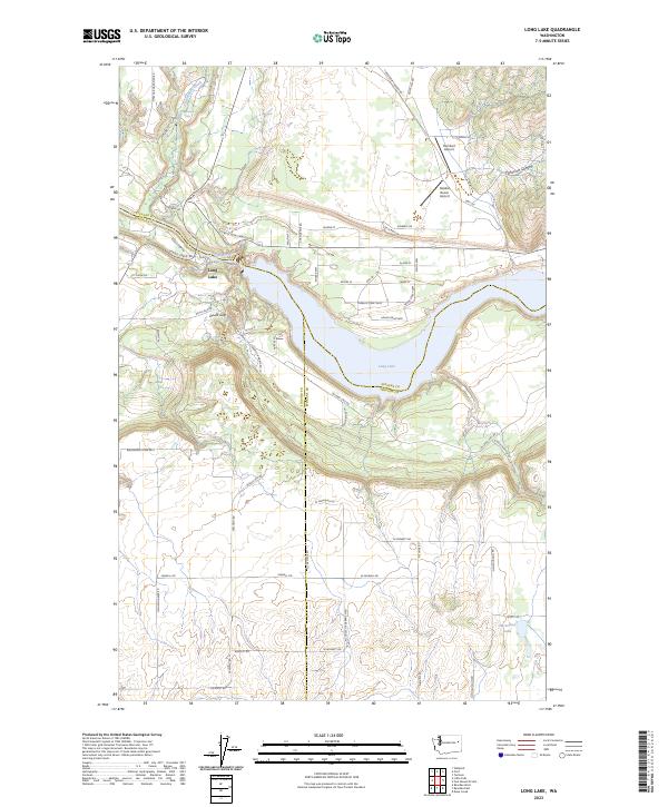
2023 Map of Long Lake
USGS Topo · Published 2023About this map
Spokane River waters define the landscape at this three-county junction, forming the expansive Long Lake which stretches across the center of the terrain. The topography is marked by significant elevation changes, from the depths of Corkscrew Canyon to the notable Devils Gap and the cascading Chamokane Falls on Chamokane Creek in the north. Evidence of the region's diverse aviation and infrastructure history is visible through small airstrips like Humbert Airport and Tailskid Ranch Airport, alongside the intriguing nomenclature of Missile Site Rd. Family-named routes such as Martha Boardman Rd and Oehlschlaeger Rd grid the higher ground above the river valley, while Horseshoe Lake sits tucked into the southeastern corner. The map documents the persistent rural character of this boundary region where Stevens, Lincoln, and Spokane counties meet.
Find a feature on this map
60 named features on this map. Tap any name to fly to it.
Don’t see what you’re looking for? This feature index may not catch every label — zoom into the map to look around manually.
Map Details
Editions of this 2023 Long Lake Map
This is the sole edition of this map. No revisions or reprints were ever made.
Other maps of this area

1943 · Medical Lake
USGS Topo · 1:62,500

1944 · Clayton
USGS Topo · 1:62,500

1944 · Wellpinit
USGS Topo · 1:62,500

1945 · Reardan
USGS Topo · 1:62,500

1950 · Clayton
USGS Topo · 1:62,500

1953 · Reardan
USGS Topo · 1:62,500

1953 · Wellpinit
USGS Topo · 1:62,500

1954 · Medical Lake
USGS Topo · 1:62,500

1954 · Deep Creek
USGS Topo · 1:24,000

1955 · Spokane
USGS Topo · 1:250,000