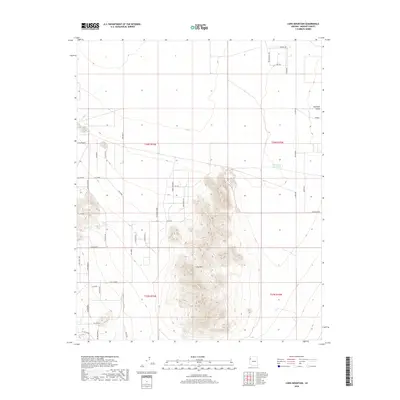
2018 Map of Long Mountain
USGS Topo · Published 2018About this map
Long Mtn anchors this section of the Hualapai Valley, where the high desert terrain is marked by a unique grid of named residential tracks and rural avenues. In the early 21st century, these high-elevation desert plains north of Kingman show a distinct settlement pattern of large-lot subdivisions. Named blocks such as Cll Ocampo, Cll Puebla, and Cll Valdez are etched into the landscape west of the mountain, while Cll Glen sits at its western base. Water management is critical in this arid environment, evidenced by the presence of the Hualapai Reservoir and Foo Tank. The map also traces seasonal drainage paths like Vock Wash, which cuts through the northwestern corner. This survey serves as a precise record of Mohave County's rural development and the road networks that have begun to crisscross the valley floor.
Find a feature on this map
42 named features on this map. Tap any name to fly to it.
Don’t see what you’re looking for? This feature index may not catch every label — zoom into the map to look around manually.
Map Details
Editions of this 2018 Long Mountain Map
This is the sole edition of this map. No revisions or reprints were ever made.
Other maps of this area

1886 · Diamond Creek
USGS Topo · 1:250,000

1886 · Camp Mohave
USGS Topo · 1:250,000

1892 · Diamond Creek
USGS Topo · 1:250,000

1892 · Camp Mohave
USGS Topo · 1:250,000

1939 · Chloride
USGS Topo · 1:48,000

1942 · Camp Mohave
USGS Topo · 1:250,000

1944 · Chloride
USGS Topo · 1:62,500

1947 · Kingman
USGS Topo · 1:250,000

1948 · Kingman
USGS Topo · 1:250,000

1948 · Williams
USGS Topo · 1:250,000