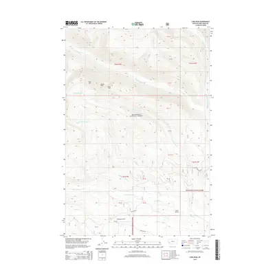
2014 Map of Long Peak
USGS Topo · Published 2014About this map
Beaverhead National Forest defines the high-altitude landscape of this area in Deer Lodge County, where several drainages carve through the mountain terrain. The topographical prominence of Long Peak, Needle Peak, and Tower Peak anchors the northwestern portion of the map, overlooking a complex network of streams including W Fork La Marche Cr and Middle Fork La Marche Cr. In the southern reaches, the drainage of Fishtrap Cr and its various branches, such as E Fork Fishtrap Cr and W Fork Fishtrap Cr, dominate the geography.
Find a feature on this map
32 named features on this map. Tap any name to fly to it.
Don’t see what you’re looking for? This feature index may not catch every label — zoom into the map to look around manually.
Map Details
Editions of this 2014 Long Peak Map
This is the sole edition of this map. No revisions or reprints were ever made.
Other maps of this area

1908 · Philipsburg
USGS Topo · 1:125,000

1947 · Butte
USGS Topo · 1:250,000

1955 · Dillon
USGS Topo · 1:250,000

1957 · Dillon
USGS Topo · 1:250,000

1958 · Butte
USGS Topo · 1:250,000

1958 · Dillon
USGS Topo · 1:250,000

1960 · Butte
USGS Topo · 1:250,000

1962 · Butte
USGS Topo · 1:250,000

1962 · Dillon
USGS Topo · 1:250,000

1962 · Lower Seymour Lake
USGS Topo · 1:24,000