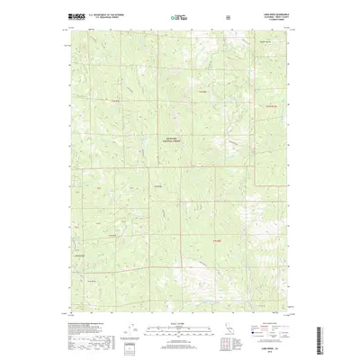
2018 Map of Long Ridge
USGS Topo · Published 2018About this map
Six Rivers National Forest encompasses this section of Trinity County, where the steep canyons of the North Fork Eel River dictate the local geography. The landscape is defined by its dramatic ridges and secluded water sources, providing a clear picture of the remote interior of Northern California. Long Ridge and Haman Ridge serve as primary landmarks for orientation, while smaller topographical features like Jerry Gulch and Hayden Roughs indicate the complex drainage systems that feed into the Eel River. The presence of Schoolhouse Spring and Climbing Spring suggests localized points of importance within the rugged terrain, possibly marking historic sites or essential water stops along the ridge roads. Tracing the paths of Cottonwood Cr and Salt Cr reveals the natural corridors through which early travel and resource management likely flowed in this forested region.
Find a feature on this map
29 named features on this map. Tap any name to fly to it.
Don’t see what you’re looking for? This feature index may not catch every label — zoom into the map to look around manually.
Map Details
Editions of this 2018 Long Ridge Map
This is the sole edition of this map. No revisions or reprints were ever made.
Other maps of this area

1920 · Covelo
USGS Topo · 1:62,500

1921 · Hoaglin
USGS Topo · 1:62,500

1922 · Island Mountain
USGS Topo · 1:62,500

1926 · Covelo
USGS Topo · 1:62,500

1931 · Hoaglin
USGS Topo · 1:96,000

1935 · Hoaglin
USGS Topo · 1:125,000

1952 · Spyrock
USGS Topo · 1:62,500

1952 · Covelo
USGS Topo · 1:62,500

1953 · Blackrock Mtn
USGS Topo · 1:62,500

1954 · Blackrock Mtn
USGS Topo · 1:62,500