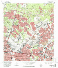
1992 Map of Longhorn
USGS Topo · Published 1993About this map
San Antonio International Airport dominates the central geography of this suburban landscape as it appeared in the early 1990s. The region is defined by rapid residential expansion into the wooded creeks of Bexar County, with sprawling neighborhoods like Hollywood Park and Hill Country Village established among the winding courses of Mud Creek and Salado Creek. Traditional ranching roots are still visible in the scattered Gravel Pit and Quarry sites and the historic presence of family burial grounds such as Classen Cem and Schumacher Cem. This era shows a community in full development, characterized by large regional shopping hubs like North Star Mall and the Windsor Park Mall, alongside an extensive network of educational institutions from Madison High Sch to Roosevelt High Sch. Industrial and logistical heritage remains at Longhorn Siding and the Texas Transportation Museum, while vast green spaces like Mc Allister Park preserve the natural breaks in the urban grid.
Find a feature on this map
70 named features on this map. Tap any name to fly to it.
Don’t see what you’re looking for? This feature index may not catch every label — zoom into the map to look around manually.
Map Details
Editions of this 1992 Longhorn Map
2 editions found
Other maps of this area

1953 · Otis Ridge
USGS Topo · 1:24,000

1953 · Schertz
USGS Topo · 1:24,000

1953 · San Antonio West
USGS Topo · 1:24,000

1953 · Bulverde
USGS Topo · 1:24,000

1953 · San Antonio East
USGS Topo · 1:24,000

1953 · Bat Cave
USGS Topo · 1:24,000

1953 · Longhorn
USGS Topo · 1:24,000

1953 · Castle Hills
USGS Topo · 1:24,000

1953 · Martinez
USGS Topo · 1:24,000

1954 · San Antonio
USGS Topo · 1:250,000