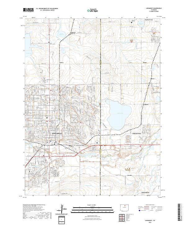
2022 Map of Longmont
USGS Topo · Published 2022About this map
Longmont serves as the primary urban center in this 2022 survey, anchoring a landscape where modern residential expansion meets a complex historical irrigation network. The density of the city is contrasted by surrounding agricultural lands and smaller settlements like Mead, Firestone, and Kirkland. The importance of water management in this Colorado region is visible through the extensive system of canals and ditches, including the Oligarchy Ditch, Highland Ditch, and Rough and Ready Ditch, which feed numerous storage basins such as Calkins Reservoir and Highland Lake. This reliance on water infrastructure defines the boundaries between town and country.
Find a feature on this map
75 named features on this map. Tap any name to fly to it.
Don’t see what you’re looking for? This feature index may not catch every label — zoom into the map to look around manually.
Map Details
Editions of this 2022 Longmont Map
This is the sole edition of this map. No revisions or reprints were ever made.
Historical Maps of Frederick Through Time
4 maps found