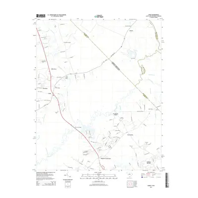
2014 Map of Longs
USGS Topo · Published 2014About this map
Worthams Ferry serves as a central landmark in this 2014 survey where the Waccamaw River snakes through the lowlands of the South Carolina and North Carolina border. The landscape is defined by the winding course of the river and its numerous tributaries, including Cawcaw Swamp and Bellamy Br. This coastal plain area exhibits a pattern of small settlements and family-named landmarks, such as Stephens Crossroads and Little Town, connected by a network of rural roads like Seven Creeks Hwy. Genealogists will find a high density of burial sites across the quadrangle, ranging from Butler Cem in the north to Mt Calvery Cem near the larger settlement of Little River in the south. The crossing at Waccamaw Bridges and the presence of Worthams Cutoff Rd illustrate how modern transit lines have been superimposed on the traditional river-and-road paths of Horry and Columbus counties.
Find a feature on this map
103 named features on this map. Tap any name to fly to it.
Don’t see what you’re looking for? This feature index may not catch every label — zoom into the map to look around manually.
Map Details
Editions of this 2014 Longs Map
This is the sole edition of this map. No revisions or reprints were ever made.
Other maps of this area

1937 · Nixonville
USGS Topo · 1:48,000

1942 · Nixonville
USGS Topo · 1:62,500

1943 · Little River
USGS Topo · 1:31,680

1943 · Pireway
USGS Topo · 1:31,680

1943 · Calabash
USGS Topo · 1:31,680

1943 · Wampee
USGS Topo · 1:24,000

1943 · Freeland
USGS Topo · 1:24,000

1944 · Longs
USGS Topo · 1:31,680

1949 · Georgetown
USGS Topo · 1:250,000
1953 · Little River
USGS Topo · 1:24,000