
1944 Map of Longs
USGS Topo · Published 1944About this map
Worthams Ferry serves as a central landmark in this 1940s landscape, providing a vital crossing point on the winding Waccamaw River south of the State Line. The region is defined by extensive wetlands such as Camp Swamp and Simpson Creek, where the terrain transitions into the high ground of Bug Hill. Settlement patterns are concentrated along the roads, with the community of Longs featuring the Ebenezer Sch and nearby Little Town.
Find a feature on this map
60 named features on this map. Tap any name to fly to it.
Don’t see what you’re looking for? This feature index may not catch every label — zoom into the map to look around manually.
Map Details
Editions of this 1944 Longs Map
This is the sole edition of this map. No revisions or reprints were ever made.
Other maps of this area

1937 · Nixonville
USGS Topo · 1:48,000

1942 · Nixonville
USGS Topo · 1:62,500

1943 · Little River
USGS Topo · 1:31,680

1943 · Pireway
USGS Topo · 1:31,680

1943 · Calabash
USGS Topo · 1:31,680

1943 · Wampee
USGS Topo · 1:24,000

1943 · Freeland
USGS Topo · 1:24,000

1949 · Georgetown
USGS Topo · 1:250,000
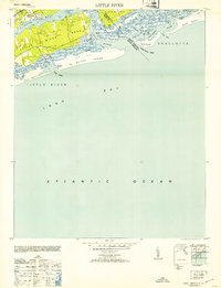
1953 · Little River
USGS Topo · 1:24,000

1953 · Longs
USGS Topo · 1:24,000