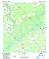
1990 Map of Longs
USGS Topo · Published 1991About this map
The Waccamaw River carves a broad, winding path through the low-lying terrain of the Carolina borderlands, defining much of this 1990 landscape. The massive Waccamaw River Swamp dominates the central and eastern portions of the sheet, where seasonal flooding and dense vegetation historically dictated the pace of development. Scattered settlements like Longs and Little Town are situated on slightly higher ground, connected by rural routes that intersect at Stephens Crossroads. This area reflects a long-standing reliance on river crossings, evidenced by the location of Worthams Ferry.
Find a feature on this map
43 named features on this map. Tap any name to fly to it.
Don’t see what you’re looking for? This feature index may not catch every label — zoom into the map to look around manually.
Map Details
Editions of this 1990 Longs Map
This is the sole edition of this map. No revisions or reprints were ever made.
Other maps of this area

1937 · Nixonville
USGS Topo · 1:48,000

1942 · Nixonville
USGS Topo · 1:62,500

1943 · Little River
USGS Topo · 1:31,680

1943 · Pireway
USGS Topo · 1:31,680

1943 · Calabash
USGS Topo · 1:31,680

1943 · Wampee
USGS Topo · 1:24,000

1943 · Freeland
USGS Topo · 1:24,000

1944 · Longs
USGS Topo · 1:31,680

1949 · Georgetown
USGS Topo · 1:250,000
1953 · Little River
USGS Topo · 1:24,000