
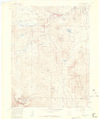
1957 Map of Longs Peak
USGS Topo · Published 1959About this map
Longs Peak dominates the southern reaches of this survey, marking a high point in the alpine landscape between the Larimer and Boulder county lines. This mid-century view shows a wilderness transitioning into a developed recreational hub, featuring established landmarks like the Estes Park Conference Camp (YMCA) and the Cheley Camp. The infrastructure for early mountaineering and tourism is evident, from the Moraine Park Museum to the Longs Peak Ranger Station and Campground.
Find a feature on this map
72 named features on this map. Tap any name to fly to it.
Don’t see what you’re looking for? This feature index may not catch every label — zoom into the map to look around manually.
Map Details
Editions of this 1957 Longs Peak Map
2 editions found
Other maps of this area

1902 · Boulder
USGS Topo · 1:62,500

1904 · Boulder
USGS Topo · 1:62,500

1905 · Mount Olympus
USGS Topo · 1:62,500

1907 · Mount Olympus
USGS Topo · 1:62,500

1915 · Longs Peak
USGS Topo · 1:125,000

1919 · Rocky Mountain National Park
USGS Topo · 1:125,000

1954 · Greeley
USGS Topo · 1:250,000

1957 · Greeley
USGS Topo · 1:250,000

1957 · Mc Henrys Peak
USGS Topo · 1:24,000

1957 · Trail Ridge
USGS Topo · 1:24,000