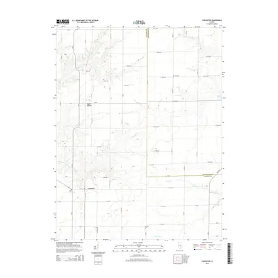
2015 Map of Loogootee
USGS Topo · Published 2015About this map
The agricultural landscape of Fayette and Effingham counties is defined by a grid of rural roads and the meandering paths of several waterways, including Little Hickory Cr and Dismal Cr. Small settlements like Saint James and Loogootee serve as local anchors, reflecting the long-standing community structure of this part of southern Illinois. The map reveals a high density of family and community burial sites scattered across the township, such as Stein Cem, Lovett Cem, and Ambuehl Cem, providing significant geographic markers for genealogical research. The terrain is further shaped by drainage features like Lone Grove Br and Walnut Cr, which cut through the level farmlands. This digital update of the 2015 landscape maintains the precise grid of county roads, including CR-2050 E and E 600th Ave, which connect the scattered farmsteads and historic landmarks of the region.
Find a feature on this map
62 named features on this map. Tap any name to fly to it.
Don’t see what you’re looking for? This feature index may not catch every label — zoom into the map to look around manually.
Map Details
Editions of this 2015 Loogootee Map
This is the sole edition of this map. No revisions or reprints were ever made.
Other maps of this area

1941 · St. Elmo
USGS Topo · 1:62,500

1945 · St. Elmo
USGS Topo · 1:62,500

1945 · Kinmundy
USGS Topo · 1:62,500

1947 · Kinmundy
USGS Topo · 1:62,500

1950 · Effingham
USGS Topo · 1:62,500

1951 · Effingham
USGS Topo · 1:62,500

1956 · Edgewood
USGS Topo · 1:62,500

1958 · Decatur
USGS Topo · 1:250,000

1958 · Belleville
USGS Topo · 1:250,000

1961 · Decatur
USGS Topo · 1:250,000