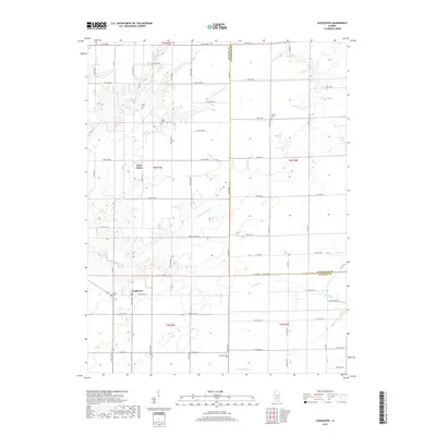
2018 Map of Loogootee
USGS Topo · Published 2018About this map
Loogootee and Saint James serve as the primary community centers in this section of Fayette County, where the landscape is defined by the drainage networks of Little Hickory Cr and Dismal Cr. The map reveals a rural geography structured by the Public Land Survey System, with a dense grid of county roads such as Co RD 1800 N and Co RD 2150 E providing access to farmlands. Genealogical value is high throughout the quadrangle, which documents several family-named burial sites including Stein Cem, Lovett Cem, and Harris Cem. To the east, the border between Fayette and Effingham counties cuts through the drainage of Fuller Cr, while Roberts Lake and Lone Grove Br offer distinct landmarks within the undulating terrain. This 2018 survey provides a precise record of the road network and water features that have shaped local settlement for generations.
Find a feature on this map
65 named features on this map. Tap any name to fly to it.
Don’t see what you’re looking for? This feature index may not catch every label — zoom into the map to look around manually.
Map Details
Editions of this 2018 Loogootee Map
This is the sole edition of this map. No revisions or reprints were ever made.
Other maps of this area

1941 · St. Elmo
USGS Topo · 1:62,500

1945 · St. Elmo
USGS Topo · 1:62,500

1945 · Kinmundy
USGS Topo · 1:62,500

1947 · Kinmundy
USGS Topo · 1:62,500

1950 · Effingham
USGS Topo · 1:62,500

1951 · Effingham
USGS Topo · 1:62,500

1956 · Edgewood
USGS Topo · 1:62,500

1958 · Decatur
USGS Topo · 1:250,000

1958 · Belleville
USGS Topo · 1:250,000

1961 · Decatur
USGS Topo · 1:250,000