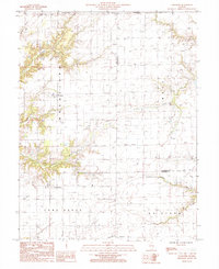
1985 Map of Loogootee
USGS Topo · Published 1985About this map
Loogootee and St James serve as the primary anchors for this rural landscape in south-central Illinois, where the border between Wheatland and West townships meets the Effingham and Fayette county line. The terrain is defined by an intricate network of drainage, primarily the southward-flowing Little Hickory Creek, Fulfer Creek, and Dismal Creek. These watercourses carve through the rolling farmland, creating a pattern of wooded riparian corridors that contrast with the open, surveyed grids of the surrounding fields.
Find a feature on this map
20 named features on this map. Tap any name to fly to it.
Don’t see what you’re looking for? This feature index may not catch every label — zoom into the map to look around manually.
Map Details
Editions of this 1985 Loogootee Map
This is the sole edition of this map. No revisions or reprints were ever made.
Other maps of this area

1941 · St. Elmo
USGS Topo · 1:62,500

1945 · St. Elmo
USGS Topo · 1:62,500

1945 · Kinmundy
USGS Topo · 1:62,500

1947 · Kinmundy
USGS Topo · 1:62,500

1950 · Effingham
USGS Topo · 1:62,500

1951 · Effingham
USGS Topo · 1:62,500

1956 · Edgewood
USGS Topo · 1:62,500

1958 · Decatur
USGS Topo · 1:250,000

1958 · Belleville
USGS Topo · 1:250,000

1961 · Decatur
USGS Topo · 1:250,000