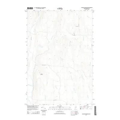
2014 Map of Lookout Mountain
USGS Topo · Published 2014About this map
Lookout Mountain stands as the central topographical prominence in this corner of Penobscot County, overlooking a complex drainage system of brooks and rivers. The western portion of the map is defined by the East Branch Penobscot River and its confluence with Wassataquoik Stream, while the Seboeis River and Little Seboeis River wind through the northern terrain. The landscape is characterized by a network of logging and local transit routes such as Sherman Lumber Rd and Frenchville Rd, which connect the scattered water bodies including Potter Pond and Wiley Pond. This 2014 survey documents the enduring wilderness character and the vital waterways that feed into the larger Penobscot watershed, reflecting the region's historical reliance on timber and water resources for its development.
Find a feature on this map
23 named features on this map. Tap any name to fly to it.
Don’t see what you’re looking for? This feature index may not catch every label — zoom into the map to look around manually.
Map Details
Editions of this 2014 Lookout Mountain Map
This is the sole edition of this map. No revisions or reprints were ever made.
Other maps of this area

1940 · Island Falls
USGS Topo · 1:62,500

1940 · Sherman
USGS Topo · 1:62,500

1942 · Island Falls
USGS Topo · 1:62,500

1942 · Sherman
USGS Topo · 1:62,500

1953 · Stacyville
USGS Topo · 1:62,500

1954 · Shin Pond
USGS Topo · 1:62,500

1954 · Presque Isle
USGS Topo · 1:250,000

1954 · Millinocket
USGS Topo · 1:250,000

1958 · Presque Isle
USGS Topo · 1:250,000

1958 · Millinocket
USGS Topo · 1:250,000