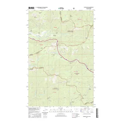
2017 Map of Lookout Pass
USGS Topo · Published 2017About this map
Lookout Pass and the surrounding Bitterroot Mountains define this critical crossing between Idaho and Montana, where transportation routes have historically converged. This 2017 survey shows the modern footprint of travel through the rugged terrain, including the path of the Old Yellowstone Trl and the development of the Hiawatha Rail-Trail. Small settlements like Sohon, Borax, and Roland are plotted along these mountain corridors, reflecting the enduring legacy of the railroad and mining era in the Bitterroots.
Find a feature on this map
65 named features on this map. Tap any name to fly to it.
Don’t see what you’re looking for? This feature index may not catch every label — zoom into the map to look around manually.
Map Details
Editions of this 2017 Lookout Pass Map
This is the sole edition of this map. No revisions or reprints were ever made.
Other maps of this area

1901 · Coeur D'Alene District
USGS Topo · 1:62,500

1903 · Coeur D'Alene District
USGS Topo · 1:62,500

1906 · Coeur D'Alene District
USGS Topo · 1:62,500

1914 · Avery
USGS Topo · 1:125,000

1917 · Avery
USGS Topo · 1:125,000

1932 · Trout Creek
USGS Topo · 1:125,000

1935 · Trout Creek
USGS Topo · 1:125,000

1936 · Trout Creek
USGS Topo · 1:125,000

1956 · Cooper Gulch
USGS Topo · 1:62,500

1956 · Saltese
USGS Topo · 1:62,500