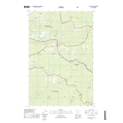
2020 Map of Lookout Pass
USGS Topo · Published 2020About this map
Lookout Pass sits at the high point of this rugged Bitterroot Mountains corridor, marking the shared boundary of Idaho and Montana. This survey details a landscape defined by historic transportation routes, where the Old Yellowstone Trl and the former rail beds of the Hiawatha Rail Trail navigate the steep grades of the Coeur d'Alene Mountains. The map reveals the intricate engineering required to cross the divide, most notably at the Saint Paul Pass Tunnel near the settlement of East Portal. Small outposts like Sohon and Borax are positioned along the upper reaches of the Saint Regis River, while high-altitude features like Saint Regis Lake and Copper Lake drain into the narrow valleys below. The map also traces the winding courses of Bullion Cr and Frazer Cr within the protected lands of the Coeur d'Alene National Forest and Lolo National Forest.
Find a feature on this map
69 named features on this map. Tap any name to fly to it.
Don’t see what you’re looking for? This feature index may not catch every label — zoom into the map to look around manually.
Map Details
Editions of this 2020 Lookout Pass Map
This is the sole edition of this map. No revisions or reprints were ever made.
Other maps of this area

1901 · Coeur D'Alene District
USGS Topo · 1:62,500

1903 · Coeur D'Alene District
USGS Topo · 1:62,500

1906 · Coeur D'Alene District
USGS Topo · 1:62,500

1914 · Avery
USGS Topo · 1:125,000

1917 · Avery
USGS Topo · 1:125,000

1932 · Trout Creek
USGS Topo · 1:125,000

1935 · Trout Creek
USGS Topo · 1:125,000

1936 · Trout Creek
USGS Topo · 1:125,000

1956 · Cooper Gulch
USGS Topo · 1:62,500

1956 · Saltese
USGS Topo · 1:62,500