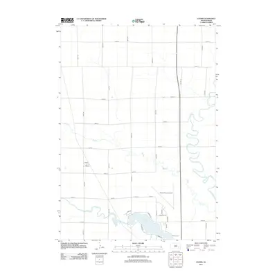
2012 Map of Loomis
USGS Topo · Published 2012About this map
Lake Mitchell dominates the southern portion of this landscape, where the waters of Firesteel Cr are impounded northwest of the city center. This 2012 survey illustrates the agricultural grid of Davison County, defined by north-south avenues like 407th Ave and east-west streets such as 245th St. To the east, the James River snakes through the terrain in a series of tight oxbows, creating a stark contrast to the rigid geometry of the surrounding section lines. Local infrastructure is prominently featured, including the Mitchell Municipal Airport and the Starlite Drive-In, indicating the intersection of regional transportation and community recreation. The presence of Dry Run across several sections highlights the drainage patterns that influence the local topography between the James River and the lake shore.
Find a feature on this map
32 named features on this map. Tap any name to fly to it.
Don’t see what you’re looking for? This feature index may not catch every label — zoom into the map to look around manually.
Map Details
Editions of this 2012 Loomis Map
This is the sole edition of this map. No revisions or reprints were ever made.
Other maps of this area

1899 · Mitchell
USGS Topo · 1:125,000

1899 · Alexandria
USGS Topo · 1:125,000

1955 · Sioux Falls
USGS Topo · 1:250,000

1955 · Mitchell
USGS Topo · 1:250,000

1957 · Farwell NW
USGS Topo · 1:24,000

1957 · Loomis
USGS Topo · 1:24,000

1957 · Riverside
USGS Topo · 1:24,000

1957 · Letcher NE
USGS Topo · 1:24,000

1957 · Farwell
USGS Topo · 1:24,000

1957 · Mitchell
USGS Topo · 1:24,000