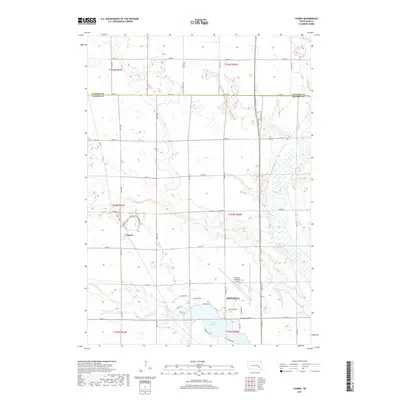
2017 Map of Loomis
USGS Topo · Published 2017About this map
Loomis sits as a quiet focal point in a landscape defined by the agricultural grid of Davison County and the winding course of the James River. The northern outskirts of Mitchell reach into the southern edge of the sheet, where the industrial and residential development near Lake Mitchell contrasts with the surrounding section-line roads and open fields. This area is a network of managed water and transport, with Firesteel Creek and Dry Run cutting through the terrain to feed the river system. The presence of the Mitchell Municipal Airport and the intersection of routes like Co Hwy 21 show the modern connectivity of this prairie region. The boundary between Sanborn and Davison counties marks the upper portion of the survey, dividing the rural sections that support the regional economy.
Find a feature on this map
44 named features on this map. Tap any name to fly to it.
Don’t see what you’re looking for? This feature index may not catch every label — zoom into the map to look around manually.
Map Details
Editions of this 2017 Loomis Map
This is the sole edition of this map. No revisions or reprints were ever made.
Other maps of this area

1899 · Mitchell
USGS Topo · 1:125,000

1899 · Alexandria
USGS Topo · 1:125,000

1955 · Sioux Falls
USGS Topo · 1:250,000

1955 · Mitchell
USGS Topo · 1:250,000

1957 · Farwell NW
USGS Topo · 1:24,000

1957 · Loomis
USGS Topo · 1:24,000

1957 · Riverside
USGS Topo · 1:24,000

1957 · Letcher NE
USGS Topo · 1:24,000

1957 · Farwell
USGS Topo · 1:24,000

1957 · Mitchell
USGS Topo · 1:24,000