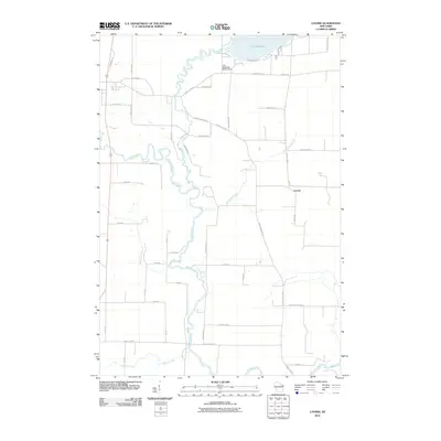
2010 Map of Loomis
USGS Topo · Published 2010About this map
Loomis serves as the central settlement in this portion of Marinette County, situated in a landscape defined by a complex network of waterways. The northern edge of the map is dominated by the sprawling Lake Noquebay, which feeds into The Outlet through the Lake Noquebay WP301 Dam. These waters eventually join the winding path of the Peshtigo River, which meanders south through the quadrangle. The river's course is joined by several tributaries, including Peterman Brook, Left Foot Creek, and Beaver Creek near the southern border.
Find a feature on this map
43 named features on this map. Tap any name to fly to it.
Don’t see what you’re looking for? This feature index may not catch every label — zoom into the map to look around manually.
Map Details
Editions of this 2010 Loomis Map
This is the sole edition of this map. No revisions or reprints were ever made.
Other maps of this area

1939 · Porterfield
USGS Topo · 1:48,000

1940 · Athelstane
USGS Topo · 1:48,000

1941 · Coleman
USGS Topo · 1:48,000

1942 · Athelstane
USGS Topo · 1:48,000

1942 · Coleman
USGS Topo · 1:48,000

1942 · Porterfield
USGS Topo · 1:48,000

1942 · Wausaukee
USGS Topo · 1:48,000

1947 · Wausaukee
USGS Topo · 1:48,000

1950 · Coleman
USGS Topo · 1:48,000

1954 · Iron Mountain
USGS Topo · 1:250,000