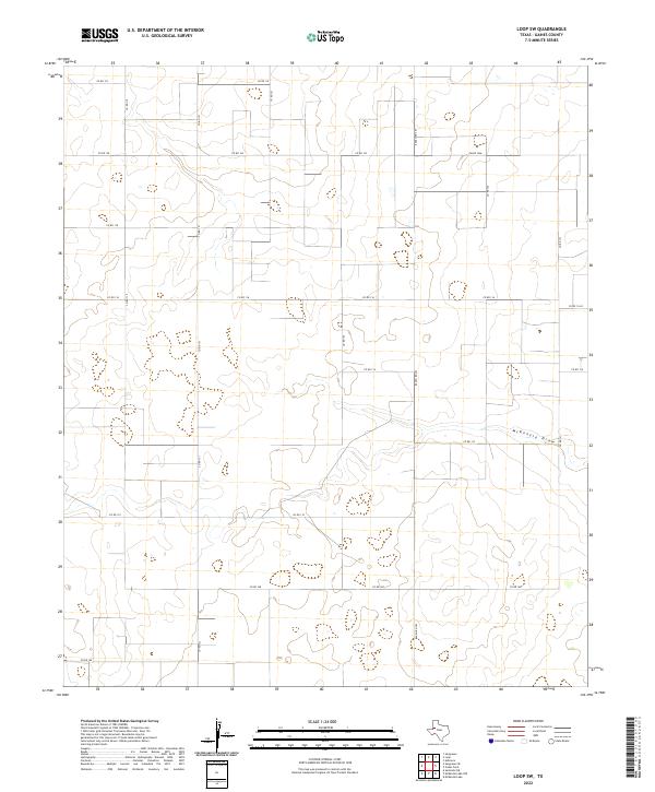
2022 Map of Loop SW
USGS Topo · Published 2022About this map
McKenzie Draw snakes across the southern portion of this high plains landscape in Gaines County, providing a rare natural break in an otherwise highly structured agricultural grid. This survey by the U.S. Geological Survey reveals a territory almost entirely defined by its rural road network, with numbered routes like Co Rd 121 and Co Rd 116 carving the terrain into precise rectangular sections. The intersection of Ranch Rd 303 and Fm Rd 1066 serves as a primary navigation point for this section of West Texas, where the local economy and land ownership are tied to these long, straight stretches of asphalt and dirt. The drainage pattern of the draw suggests the subtle topography that governs water movement in this semi-arid region, a detail critical for understanding historical land use and early ranching boundaries.
Find a feature on this map
19 named features on this map. Tap any name to fly to it.
Don’t see what you’re looking for? This feature index may not catch every label — zoom into the map to look around manually.
Map Details
Editions of this 2022 Loop SW Map
This is the sole edition of this map. No revisions or reprints were ever made.
Other maps of this area

1954 · Hobbs
USGS Topo · 1:250,000

1958 · Hobbs
USGS Topo · 1:250,000

1969 · Loop
USGS Topo · 1:24,000

1969 · Ashmore
USGS Topo · 1:24,000

1970 · Seminole NE
USGS Topo · 1:24,000

1970 · Seagraves SE
USGS Topo · 1:24,000

1970 · McKenzie Lake NW
USGS Topo · 1:24,000

1970 · Seagraves
USGS Topo · 1:24,000
1970 · Loop SW
USGS Topo · 1:24,000

1970 · McKenzie Lake
USGS Topo · 1:24,000