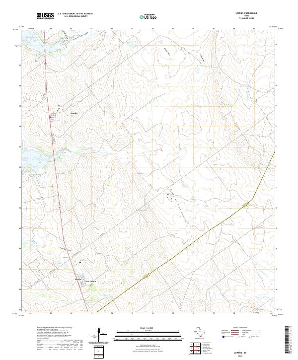
2022 Map of Lopeno
USGS Topo · Published 2022About this map
The waters of the Falcon Reservoir and its various inlets dominate the western edge of this South Texas landscape along the border of Zapata and Starr counties. The settlements of Lopeño and Falcon are central to the area's geography, with the later addition of New Falcon reflecting the mid-20th-century relocations necessitated by the damming of the Rio Grande. Local history is anchored at the New Lopeño Cem and Falcon Cem, which serve as vital points for genealogical research in this ranching region.
Find a feature on this map
28 named features on this map. Tap any name to fly to it.
Don’t see what you’re looking for? This feature index may not catch every label — zoom into the map to look around manually.
Map Details
Editions of this 2022 Lopeno Map
This is the sole edition of this map. No revisions or reprints were ever made.
Other maps of this area

1938 · Falcon
USGS Topo · 1:62,500

1938 · El Sauz
USGS Topo · 1:62,500

1938 · Cuevitas
USGS Topo · 1:62,500

1949 · Mc Allen
USGS Topo · 1:250,000

1954 · McAllen
USGS Topo · 1:250,000

1956 · Arroyo Clareno
USGS Topo · 1:62,500

1957 · Mc Allen
USGS Topo · 1:250,000

1962 · McAllen
USGS Topo · 1:250,000

1965 · Salineno
USGS Topo · 1:24,000
1965 · Falcon Village
USGS Topo · 1:24,000