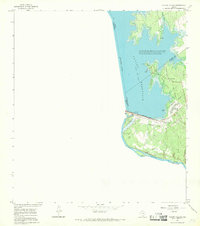
1965 Map of Falcon Village
USGS Topo · Published 1968About this map
Falcon Reservoir dominates the landscape of the borderlands during the mid-1960s, its waters gathered behind the massive Falcon Dam. This infrastructure project transformed the local economy and geography, supporting the development of Falcon Village and the adjacent Falcon State Park. The map documents a highly regulated environment where the international boundary between the United States and Mexico runs through the center of the reservoir and along the Rio Grande below the spillway.
Find a feature on this map
20 named features on this map. Tap any name to fly to it.
Don’t see what you’re looking for? This feature index may not catch every label — zoom into the map to look around manually.
Map Details
Editions of this 1965 Falcon Village Map
This is the sole edition of this map. No revisions or reprints were ever made.
Other maps of this area

1938 · Falcon
USGS Topo · 1:62,500

1949 · Mc Allen
USGS Topo · 1:250,000

1954 · McAllen
USGS Topo · 1:250,000

1956 · Roma
USGS Topo · 1:62,500

1957 · Mc Allen
USGS Topo · 1:250,000

1962 · McAllen
USGS Topo · 1:250,000

1965 · Salineno
USGS Topo · 1:24,000

1965 · Lopeno
USGS Topo · 1:24,000
1965 · Beckwith Arm
USGS Topo · 1:24,000
1965 · Roma-Los Saenz West
USGS Topo · 1:24,000