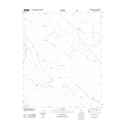
2012 Map of Lopez Mountain
USGS Topo · Published 2012About this map
Lopez Mountain and the surrounding Santa Lucia Range define this high-country landscape just northeast of San Luis Obispo. The terrain is deeply incised by drainages such as Sycamore Canyon and Big Falls Canyon, which feed into major waterways like the Salinas River and the southern reach of Santa Margarita Lake. This 2012 survey illustrates the connectivity between the coast and the interior, highlighting a network of forest routes and historic corridors including Old 101, W Pozo Rd, and the High Mountain Lookout Rd.
Find a feature on this map
39 named features on this map. Tap any name to fly to it.
Don’t see what you’re looking for? This feature index may not catch every label — zoom into the map to look around manually.
Map Details
Editions of this 2012 Lopez Mountain Map
This is the sole edition of this map. No revisions or reprints were ever made.
Other maps of this area

1897 · San Luis Obispo
USGS Topo · 1:62,500

1897 · Arroyo Grande
USGS Topo · 1:62,500

1900 · San Luis
USGS Topo · 1:125,000

1922 · Pozo
USGS Topo · 1:62,500

1922 · Nipomo
USGS Topo · 1:62,500

1942 · San Luis Obispo
USGS Topo · 1:62,500

1942 · Arroyo Grande
USGS Topo · 1:62,500

1947 · San Luis Obispo
USGS Topo · 1:250,000

1948 · San Luis Obispo
USGS Topo · 1:250,000

1952 · Arroyo Grande
USGS Topo · 1:62,500