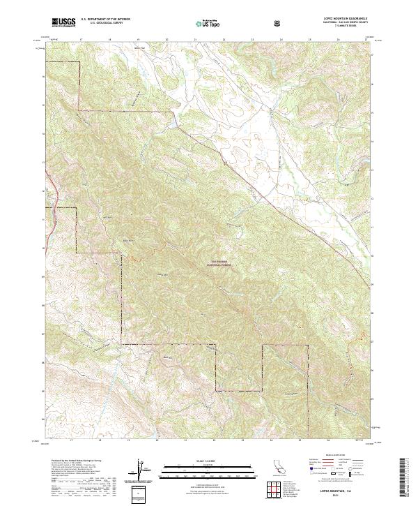
2021 Map of Lopez Mountain
USGS Topo · Published 2021About this map
Los Padres National Forest dominates this California landscape, where the Santa Lucia Range transitions into complex drainages and ridges. The map highlights a significant piece of modern infrastructure, the Governor Edmund G Brown Coast Br/California Aqueduct, which cuts through the southwestern terrain near Oil Well Canyon. Peaks like Lopez Mtn and Mt Lowe provide the high ground for a network of forest routes, including Mount Lowe Rd and the Lopez Canyon Trl. The inclusion of historical corridors like El Camino Real and Stage Coach Rd reflects the long-standing transport routes of San Luis Obispo County. Geologic and natural interest points are found at the Sulphur Pots along Potrero Cr and the sheer drops of Big Falls Canyon.
Find a feature on this map
55 named features on this map. Tap any name to fly to it.
Don’t see what you’re looking for? This feature index may not catch every label — zoom into the map to look around manually.
Map Details
Editions of this 2021 Lopez Mountain Map
This is the sole edition of this map. No revisions or reprints were ever made.
Other maps of this area

1897 · San Luis Obispo
USGS Topo · 1:62,500

1897 · Arroyo Grande
USGS Topo · 1:62,500

1900 · San Luis
USGS Topo · 1:125,000

1922 · Pozo
USGS Topo · 1:62,500

1922 · Nipomo
USGS Topo · 1:62,500

1942 · San Luis Obispo
USGS Topo · 1:62,500

1942 · Arroyo Grande
USGS Topo · 1:62,500

1947 · San Luis Obispo
USGS Topo · 1:250,000

1948 · San Luis Obispo
USGS Topo · 1:250,000

1952 · Arroyo Grande
USGS Topo · 1:62,500